Environmental Monitoring
Mission Statement
LUMCON’s goal is to document and quantify the changing landscape by leveraging high-resolution monitoring in the coastal southeastern Louisiana region. This will include the design and implementation of scientific surveys, monitoring programs and investigations of the chemical, geologic, atmospheric, and biological environments.
LUMCON-GENERATED DATA
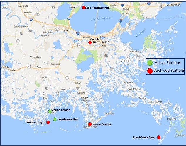
LUMCON’s monitoring stations are equipped with meteorological and hydrographic instrumentation. The operational stations collect and archive real-time data. To view our real-time data please click here.
The DeFelice Marine Center tower is equipped with cameras that display views north, south, east, and west. To view these please click here.
If you have any questions or concerns or would like information on the instruments we use to gather this data, please email [email protected].

eBird Observation Data
The buttons will redirect you to eBird. From eBird you can view bird observation data collected around the Marine Center by LUMCON staff and other eBird members through the links below.
eBird is is managed by the Cornell Lab of Ornithology to gather information in the form of checklists of birds, archive it, and freely share it to power new data-driven approaches to science, conservation and education.